File:Uct-area-map-rotated.png
From Wiki
Size of this preview: 721 × 600 pixels.
Original file (2,072 × 1,723 pixels, file size: 906 KB, MIME type: image/png)
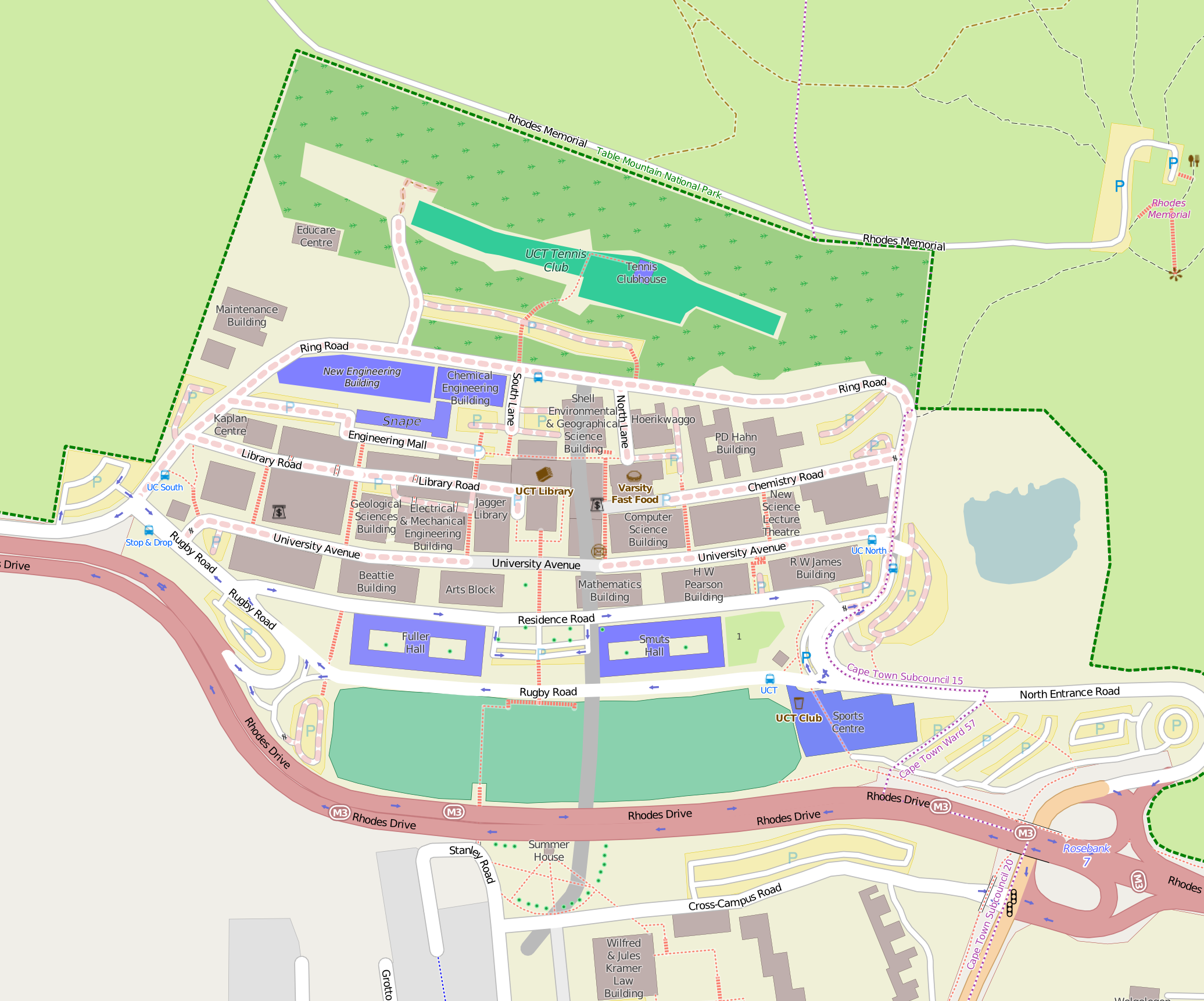
Map of UCT Upper Campus.
© OpenStreetMap contributors OpenStreetMap is open data, licensed under the Open Data Commons Open Database License (ODbL).
You are free to copy, distribute, transmit and adapt our data, as long as you credit OpenStreetMap and its contributors. If you alter or build upon our data, you may distribute the result only under the same licence. The full legal code explains your rights and responsibilities.
The cartography in our map tiles, and our documentation, are licensed under the Creative Commons Attribution-ShareAlike 2.0 license (CC BY-SA).
File history
Click on a date/time to view the file as it appeared at that time.
| Date/Time | Thumbnail | Dimensions | User | Comment | |
|---|---|---|---|---|---|
| current | 04:10, 1 December 2014 | | 2,072 × 1,723 (906 KB) | Stefanor (Talk | contribs) | Map of UCT Upper Campus. © OpenStreetMap contributors OpenStreetMap is open data, licensed under the Open Data Commons Open Database License (ODbL). You are free to copy, distribute, transmit and adapt our data, as long as you credit OpenStreetMap a... |
- Edit this file using an external application (See the setup instructions for more information)
File usage
The following page links to this file: